25. Detaille Island |
||||||||||||

|
||||||||||||
|---|---|---|---|---|---|---|---|---|---|---|---|---|
|
||||||||||||
|
||||||||||||
| Description | ||||||||||||
| TOPOGRAPHY | ||||||||||||
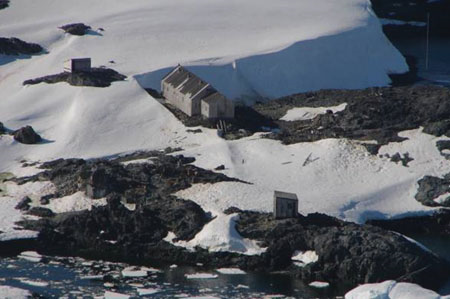
| Detaille is a small island set in the Lallemand Fjord off the Loubet coast. The ground is predominantly rocky with areas of gravel. | ||||||||||||
| FLORA | ||||||||||||
| In the absence of any detailed floristic survey, only one species of lichen has been recorded at Detaille Island. | ||||||||||||
| OTHER | ||||||||||||
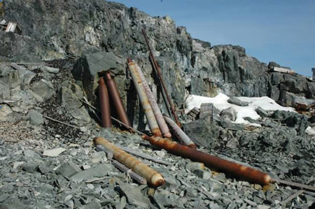
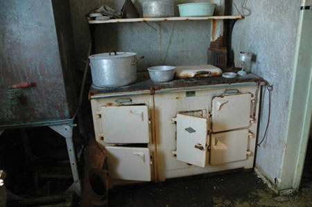
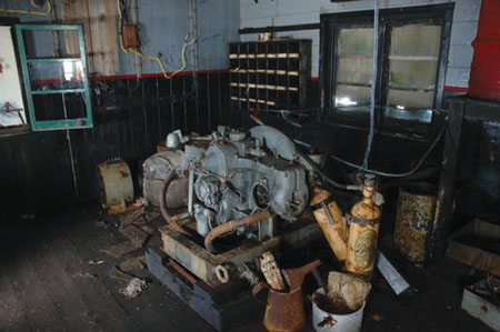
| Base ‘W’ is designated as Historic Site and Monument No. 83. It is sited at the northern end of the island. It is noteworthy as a relatively unaltered British scientific base of the late 1950s, providing an evocative insight into the way the bases were occupied during this period. It was built in 1956 and closed in 1959 due to the difficulty of accessing the base. It was subsequently reoccupied for six months in 1965/66. During its short history as an occupied base it contributed towards the geophysical programme of the International Geophysical Year (IGY). In addition to the base building, there are also dog kennels, an emergency store, fuel drum and cargo depots, an anemometer tower and wireless masts. | ||||||||||||
| Visitor Impact | ||||||||||||
| KNOWN IMPACTS | ||||||||||||
| None known. | ||||||||||||
| POTENTIAL IMPACTS | ||||||||||||
| Fire. Minor fuel spills. Disturbance of historic artefacts. | ||||||||||||
| Landing Requirements | ||||||||||||
| SHIPS* | ||||||||||||
|
Max pax on board: 500
Ships at a time: 1 Comments: Maximum 2 ships per day (midnight to midnight), of which no more than 1 can carry over 200 passengers. * A ship is defined as a vessel which carries more than 12 passengers. |
||||||||||||
| VISITORS | ||||||||||||
|
Maximum number of visitors at any time, exclusive of expedition guides and leaders: 50 Comments: No more than 12 visitors are allowed inside the base at any one time**. Visitors must be closely supervised. Base ‘W’ was proposed as HSM No. 83 by the UK. Visits to the hut may only take place with prior permission given by a Party. The Party undertaking management of the site should also be informed prior to the visit. **Visitors enter the base at their own risk and the UK authorities will not be liable for any personal injury or damage to property that may be sustained. |
||||||||||||
| Visitor Area | ||||||||||||
| LANDING AREA | ||||||||||||
| The preferred landing site is in the small bay to the south of the hut. | ||||||||||||
| CLOSED AREA | ||||||||||||
| Visitors should not access any of the secondary huts or other structures. | ||||||||||||
| GUIDED WALKING AREA | ||||||||||||
| None. | ||||||||||||
| FREE ROAMING AREA | ||||||||||||
| Visitors may roam freely under close supervision. | ||||||||||||
| Visitor code of conduct | ||||||||||||
| BEHAVIOUR ASHORE | ||||||||||||
|
||||||||||||
| CAUTIONARY NOTES | ||||||||||||
|
Boat drivers should be aware of submerged rocks on approaching the landing site. The rocks at the landing site can be slippery when wet. |
||||||||||||

|
||||||||||||
|
||||||||||||

|
||||||||||||
|
|
Please note that ATCM / CEP circulars are available only to specific contact points.
Please contact your Party Contact Administrator, to confirm if you have privileges to access this section.
To access this section you must log in using your personal Username/Email and password as registered in the AT Contacts Database.
To access this section you must log in using your personal Username/Email and password as registered in the AT Contacts Database.
If you are not registered, please request your party’s Contact Administrator to assign your credentials or contact the Secretariat for assistance.