16. Devil Island – Vega Island |
||||||||||||

|
||||||||||||
|---|---|---|---|---|---|---|---|---|---|---|---|---|
|
||||||||||||
|
||||||||||||
| Description | ||||||||||||
| TOPOGRAPHY | ||||||||||||
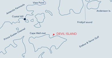
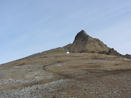
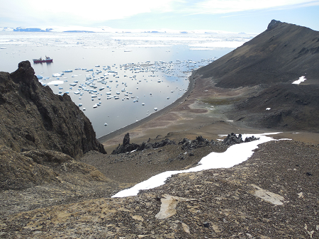
| This narrow 2 km long island is so named for the two peaks located at either end of the island separated by a low lying valley creating a horned effect. The peaks are fringed by cliffs on their north facing side creating an amphitheatre effect on the north shore where the penguin colony is located. The peaks slope off to the south. The site consists primarily of loose gravel with a distinct raised beach along the northern shore. The rock face along parts of the beach is made up of distinct and spectacular volcanic rock formations. | ||||||||||||
| FAUNA | ||||||||||||
| Confirmed breeders: Adélie penguin, Skua. | ||||||||||||
| Hauled out: Antarctic fur seal. | ||||||||||||
| Offshore: Leopard seal. | ||||||||||||
| Suspected Breeders: Kelp gull, Snowy sheathbill, Wilson’s storm-petrel. | ||||||||||||
| FLORA | ||||||||||||
| Lichens (Usnea Antarctica, Xanthoria, spp. and Caloplaca, spp.) observed on higher slopes of north eastern peak. Large area of moss spp. situated on flat area behind penguin colony. | ||||||||||||
| Visitor Impact | ||||||||||||
| KNOWN IMPACTS | ||||||||||||
| Erosion of footpaths. | ||||||||||||
| POTENTIAL IMPACTS | ||||||||||||
| Disturbance of wildlife, trampling of vegetation, further erosion of footpaths. | ||||||||||||
| Landing Requirements | ||||||||||||
| SHIPS* | ||||||||||||
|
Max pax on board: 200
Ships per day: 2 |
||||||||||||
| VISITORS | ||||||||||||
|
Maximum number of visitors at any time, exclusive of expedition guides and leaders: 100 Visitors per guide: 20 Curfew time period (from/to), in order to establish a rest period for wildlife: 22:00-04:00 |
||||||||||||
| Visitor Area | ||||||||||||
| LANDING AREA | ||||||||||||
|
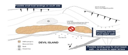
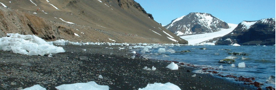
Possible south side landing: Beach below the steep volcanic rock face on northern coast of island, to the west of the semi submerged reef which runs from the western end of the north shore out at a diagonal to the shore. Possible short walk landing: If south side site is heavy with snow/ice visitors may choose to land on the beach area further to east, directly in front of colony if it is high tide. Extreme care must be taken on the approach. Ice may be a factor when landing on the South Side of the island, and should be monitored. The landing beach on the South Side can be steep in places and will require appropriate marking of route by guides. Landings are possible on the north side, but only for short walks to where the first penguin colony begins. At certain times of the season these landings may not be possible due to penguin traffic on the water's edge. |
||||||||||||
| CLOSED AREA | ||||||||||||
|
Closed Area A: Vegetation patch situated behind the Adélie colony. Northern Side of the Island: The previous gap between the penguin colonies utilized for transiting to the top of the terrace and further to the overlook, now narrows to less than 1m/3ft in some places due to penguin nests. |
||||||||||||
| GUIDED WALKING AREA | ||||||||||||
|
Along the beach from the southern landing site and up a short steep slope from the beach to the raised beach area behind. Talk should be flagged and closely guided with no more than 20 people in the area at one time. Walks to the top of the south-western peak should be flagged. A single track should be followed to prevent creation of ribbon paths. Landings are possible on the north side, but only for short walks to where the first penguin colony begins. Landings for longer walks to the overlook and across the island to the Penguin colonies should be done from the South Side of the island. |
||||||||||||
| FREE ROAMING AREA | ||||||||||||
| Visitors may roam freely in the immediate landing area at low tide and along the beach. | ||||||||||||
| Visitor code of conduct | ||||||||||||
| BEHAVIOUR ASHORE | ||||||||||||
|
||||||||||||
| CAUTIONARY NOTES | ||||||||||||
|
• Landing may be difficult at high water or if extensive ice present on shore. • Hazardous rocks and band of reef lie immediately off shore the northern shore. Bergy bits, growlers and brash regularly get stranded on the reef. These can fracture suddenly during stranding or subsequent re-floating. Particular caution should be taken when using small boats and kayaks. • Strong winds and tidal variation can bring pack and brash ice quickly onto the beach area. • On the col leading to the peak the western side of ridge drops off very steeply – extreme care should be taken. Visitors should stick to marked paths. |
||||||||||||
|
||||||||||||
| Landing beach | ||||||||||||
|
||||||||||||

|
||||||||||||
|
|
Please note that ATCM / CEP circulars are available only to specific contact points.
Please contact your Party Contact Administrator, to confirm if you have privileges to access this section.
To access this section you must log in using your personal Username/Email and password as registered in the AT Contacts Database.
To access this section you must log in using your personal Username/Email and password as registered in the AT Contacts Database.
If you are not registered, please request your party’s Contact Administrator to assign your credentials or contact the Secretariat for assistance.