38. Point Wild |
||||||||||||

|
||||||||||||
|---|---|---|---|---|---|---|---|---|---|---|---|---|
|
||||||||||||
|
||||||||||||
| Description | ||||||||||||
| TOPOGRAPHY | ||||||||||||
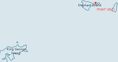
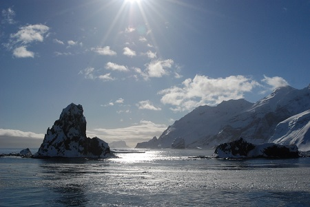
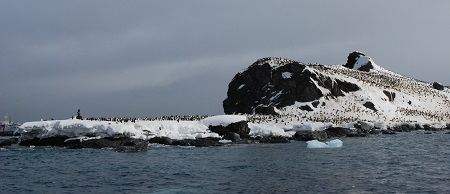
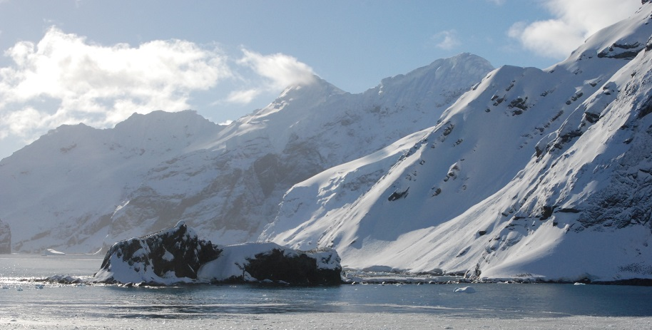
| A small, low lying, narrow, sand and rock point, rising to a small rock outcrop at the northerly end. Steep tidewater glaciers and cliffs fringe the point. Large icebergs often ground on off shore pinnacles. | ||||||||||||
| FAUNA | ||||||||||||
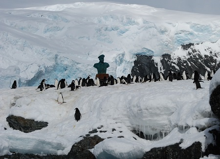
| Confirmed breeders: Antarctic tern, chinstrap Penguin, Kelp gull. | ||||||||||||
| Present late in the season: Cetaceans, Finback whale, Humpback Whale. | ||||||||||||
| Regularly haul out: Antarctic fur seal. | ||||||||||||
| Seen near-shore: Leopard seal, Weddell seal. | ||||||||||||
| Seen off-shore: Cetaceans, Finback whale, Humpback Whale. | ||||||||||||
| Suspected Breeders: Snowy sheathbill, Wilson’s storm-petrel. | ||||||||||||
| FLORA | ||||||||||||
| Small patches of bearded and crustose lichen species including Xanthoria spp., Buellia spp., Caloplaca spp., Usnea spp. | ||||||||||||
| OTHER | ||||||||||||
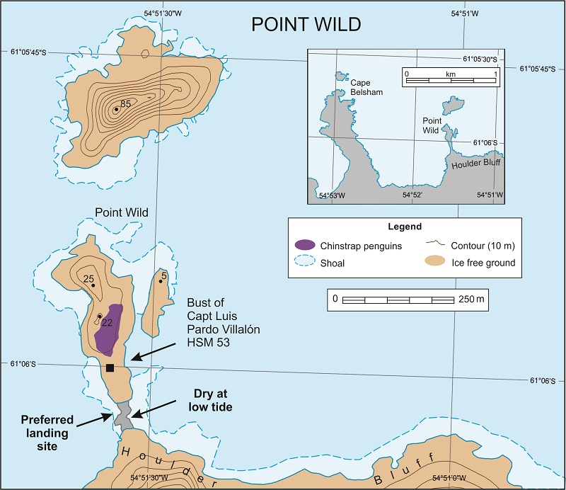
| The site is the location where the crew of Sir Ernest Shackleton’s shipwrecked Endurance expedition camped for four months until rescued in August 1916 by the Chilean Naval vessel Yelcho, commanded by Captain Luis Alberto Pardo. It is the location of HSM 53 which consists of a Bust of Captain Pardo, a monolith and plaques celebrating his rescue of Shackleton’s men. | ||||||||||||
| Visitor Impact | ||||||||||||
| KNOWN IMPACTS | ||||||||||||
| None known. | ||||||||||||
| POTENTIAL IMPACTS | ||||||||||||
| Disturbance to wildlife and damage to historic artefacts. | ||||||||||||
| Landing Requirements | ||||||||||||
| SHIPS* | ||||||||||||
|
Max pax on board: 500
Ships per day: 2 Comments: * A ship is defined as a vessel which carries more than 12 passengers. |
||||||||||||
| VISITORS | ||||||||||||
|
Curfew time period (from/to), in order to establish a rest period for wildlife: 22:00-04:00 Comments: No more than 30 visitors at any time, exclusive of expedition guides and leaders. However, this is principally a small boat cruising site with occasional opportunistic landings at low tide. If landing, see Landing Area guidance below. |
||||||||||||
| Visitor Area | ||||||||||||
| LANDING AREA | ||||||||||||
| Landings are often prohibited by the local conditions, and need to be considered on an opportunistic basis, usually with no more than one small boat at a time, depending on sea state, weather conditions and presence of wildlife. | ||||||||||||
| CLOSED AREA | ||||||||||||
| None. | ||||||||||||
| GUIDED WALKING AREA | ||||||||||||
| If setting foot ashore this should be done in small, closely guided groups (of up to 15 visitors) avoiding disturbing any wildlife present. | ||||||||||||
| FREE ROAMING AREA | ||||||||||||
| None. | ||||||||||||
| Visitor code of conduct | ||||||||||||
| BEHAVIOUR ASHORE | ||||||||||||
|
||||||||||||
| Comments: | ||||||||||||
| The rock outcrop at the southern part of the point, and the isthmus accessible at low tide connecting the point to the main island. | ||||||||||||
| CAUTIONARY NOTES | ||||||||||||
|
Small boat drivers should be aware of submerged rocks and foul waters surrounding the point, in particular to the north and along the eastern shores. Be aware that glacier or iceberg calving may produce dangerous waves. |
||||||||||||
|
||||||||||||
|
||||||||||||
|
||||||||||||
|
|
Please note that ATCM / CEP circulars are available only to specific contact points.
Please contact your Party Contact Administrator, to confirm if you have privileges to access this section.
To access this section you must log in using your personal Username/Email and password as registered in the AT Contacts Database.
To access this section you must log in using your personal Username/Email and password as registered in the AT Contacts Database.
If you are not registered, please request your party’s Contact Administrator to assign your credentials or contact the Secretariat for assistance.