22. Wordie House, Winter Island |
||||||||||||

|
||||||||||||
|---|---|---|---|---|---|---|---|---|---|---|---|---|
|
||||||||||||
|
||||||||||||
| Description | ||||||||||||
| TOPOGRAPHY | ||||||||||||
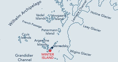
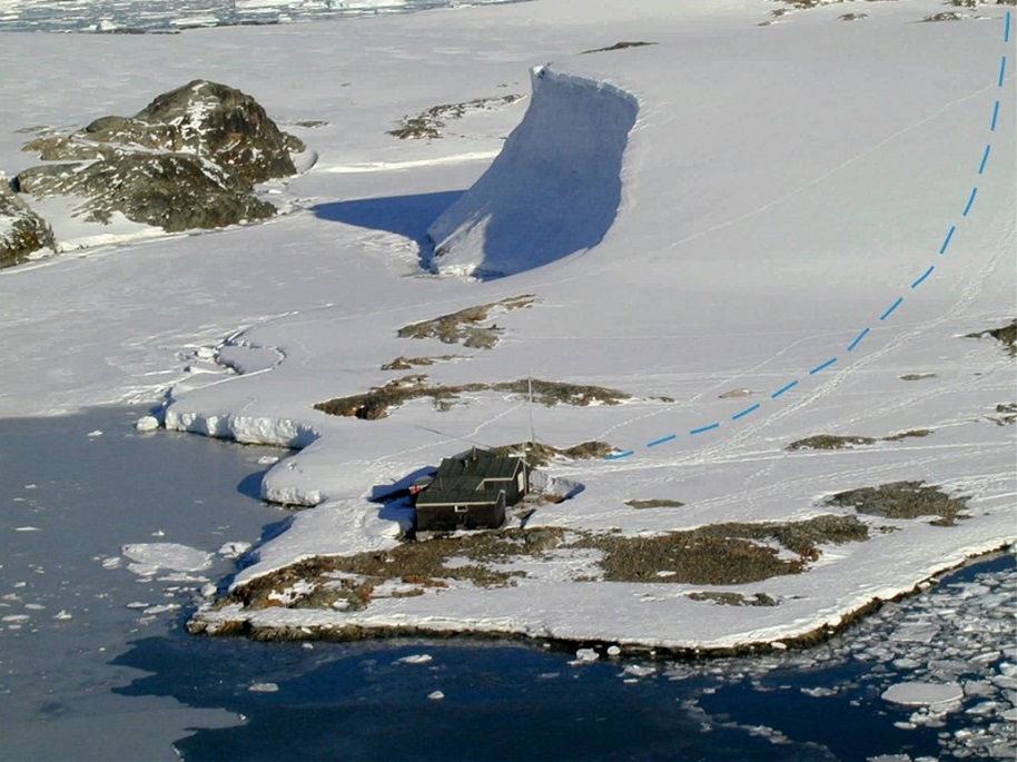
| Wordie House stands on a very small, flat peninsula on Winter Island (part of the Argentine Islands and composed entirely of igneous rocks). The hut is surrounded by water to the immediate south. A narrow channel called Stella Creek separates Winter Island from Galindez Island on which Ukrainian Vernadsky Station is situated. The surrounding islands protect the site from the open sea and in summer the area is relatively clear of snow. A large permanent snow bank is found to the west of the base. | ||||||||||||
| FAUNA | ||||||||||||
| Regularly haul out: Weddell seal. | ||||||||||||
| Also present: Adélie penguin, Blue-eyed shag, Gentoo penguin, Kelp gull, South Polar Skua, Wilson’s storm-petrel. | ||||||||||||
| FLORA | ||||||||||||
| Rhizocarpon sp. and Usnea Antarctica lichens are present on the island. The moss Polytrichum strictum is also found. | ||||||||||||
| OTHER | ||||||||||||
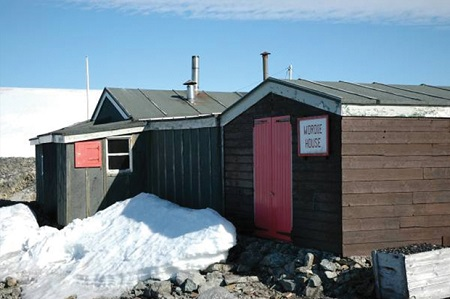
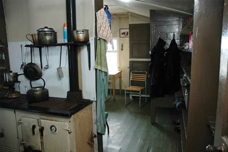
| Base ‘F’ is designated as Historic Site and Monument No. 62 under the Antarctic Treaty, and is operated by the UK Antarctic Heritage Trust. It was built in 1947 on the site of the earlier 1936 British Graham land Expedition hut, which was swept away by a tidal wave. In addition to the building, there is also a rare timber sign which dates from 1947. | ||||||||||||
| Visitor Impact | ||||||||||||
| KNOWN IMPACTS | ||||||||||||
| None. | ||||||||||||
| POTENTIAL IMPACTS | ||||||||||||
| Fire. Minor fuel spills. Wildlife disturbance. | ||||||||||||
| Landing Requirements | ||||||||||||
| SHIPS* | ||||||||||||
|
Max pax on board: 500
Ships per day: 2 |
||||||||||||
| VISITORS | ||||||||||||
|
Maximum number of visitors at any time, exclusive of expedition guides and leaders: 36 Comments: No more than 12 visitors are allowed inside the base at any one time. Visitors enter the base at their own risk and neither the UK authorities nor National Antarctic Scientific Centre, personnel from Vernadsky Station, nor the Ukraine authorities will be liable for any personal injury or damage to property that may be sustained. Base ‘F’ was proposed as HSM No 62 by the United Kingdom. The site is managed by the UK and the nearby Ukrainian Vernadsky Station. Visits to the hut may only take place with prior permission given by a Party. The Party undertaking management of the site should also be informed prior to the visit. The key for the hut is held by the Vernadsky Station Leader. Where practicable, expedition leaders are requested to invite at least one member of the Vernadsky staff to come aboard the vessel to brief passengers and staff prior to any visit taking place. |
||||||||||||
| Visitor Area | ||||||||||||
| LANDING AREA | ||||||||||||
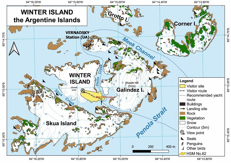
| The preferred site is on the south-east side of the island, immediately in front of the entrance to the hut. In case of emergency, helicopter landings are potentially possible at the top of the island’s ice cap. | ||||||||||||
| CLOSED AREA | ||||||||||||
| All areas not specifically designated for visitors’ activities are closed in order to preserve rich moss and lichen vegetation, and nesting areas. | ||||||||||||
| GUIDED WALKING AREA | ||||||||||||
| Visitors may conduct a guided walk on recommended route from Wordie House and nearby shore to the top of the ice cap offering glacial scenery (see the map). | ||||||||||||
| FREE ROAMING AREA | ||||||||||||
| None. | ||||||||||||
| Visitor code of conduct | ||||||||||||
| BEHAVIOUR ASHORE | ||||||||||||
|
||||||||||||
| CAUTIONARY NOTES | ||||||||||||
| The rocks at the landing site can be slippery when wet. Care should be taken when following the walk to the viewpoint at the top of the ice cap. | ||||||||||||
|
||||||||||||
| The hut seen from the east showing how close it is built to the sea (recommended visitor path to the top of the ice cap shown in the background) | ||||||||||||
|
||||||||||||
|
||||||||||||
|
|
Please note that ATCM / CEP circulars are available only to specific contact points.
Please contact your Party Contact Administrator, to confirm if you have privileges to access this section.
To access this section you must log in using your personal Username/Email and password as registered in the AT Contacts Database.
To access this section you must log in using your personal Username/Email and password as registered in the AT Contacts Database.
If you are not registered, please request your party’s Contact Administrator to assign your credentials or contact the Secretariat for assistance.