29. Damoy Point |
||||||||||||

|
||||||||||||
|---|---|---|---|---|---|---|---|---|---|---|---|---|
|
||||||||||||
|
||||||||||||
| Description | ||||||||||||
| TOPOGRAPHY | ||||||||||||
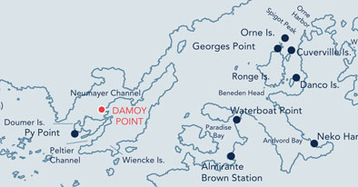
| Damoy Point is a rocky isthmus off the west coast of Wiencke Island, Antarctic Peninsula. | ||||||||||||
| FAUNA | ||||||||||||
| Confirmed breeders: Antarctic tern, Gentoo penguin, Kelp gull, Subantarctic Skua. | ||||||||||||
| Also present: Crabeater Seal, Fur seal, Leopard seal, Weddell seal. | ||||||||||||
| FLORA | ||||||||||||
| 5 species of lichen and 3 species of moss have been reported from Damoy Point, in addition to the common green alga Prasiola crispa. | ||||||||||||
| OTHER | ||||||||||||
|
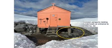
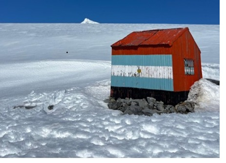
Damoy Hut is designated as Historic Site and Monument No. 84. It sits approximately 100 metres from the shoreline of Dorian Bay. The hut was established by the British Antarctic Survey (BAS) in November 1975 and was used as a transit station for BAS staff and stores to be flown south from the skiway on the glacier above the hut to Rothera Research Station when sea ice prevented access by ship. It was last occupied by BAS in 1993. The Bahía Dorian hut was established by the Argentine Navy on February 23rd, 1953. It sits in very close proximity to the British Hut and covers an area of c. 12 square metres. The hut has been used as an emergency refuge. |
||||||||||||
| Visitor Impact | ||||||||||||
| KNOWN IMPACTS | ||||||||||||
| None known. | ||||||||||||
| POTENTIAL IMPACTS | ||||||||||||
| Fire. Minor fuel spills. Disturbance of wildlife and trampling of vegetation. | ||||||||||||
| Landing Requirements | ||||||||||||
| SHIPS* | ||||||||||||
|
Max pax on board: 500
|
||||||||||||
| VISITORS | ||||||||||||
|
Maximum number of visitors at any time, exclusive of expedition guides and leaders: 100 Comments: No more than 10 visitors are allowed inside Damoy hut at any one time**. Damoy Hut was proposed as HSM 84 by the UK. Visits to this hut may only take place with prior permission given by a Party. The Party undertaking management of the site should also be informed prior to the visit. The Argentine hut should only be accessed by visitors in cases of emergency. **Visitors enter the base at their own risk and the UK authorities will not be liable for any personal injury or damage to property that may be sustained. |
||||||||||||
| Visitor Area | ||||||||||||
| LANDING AREA | ||||||||||||
|
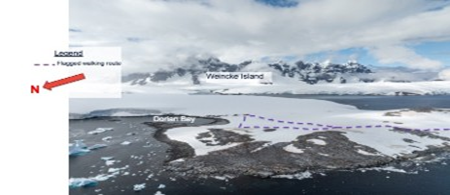
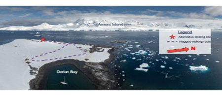
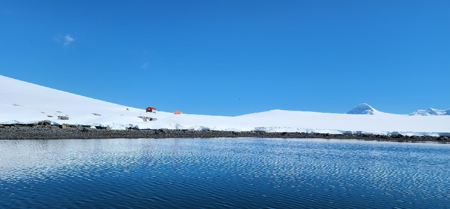
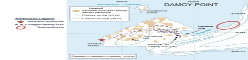
The preferred landing site is in Dorian Bay, immediately adjacent to the field huts. An alternate landing site can be found on the outer coast of Damoy Point, south of the major Gentoo penguin colonies. The approach is generally steep, with scattered boulders that are easily avoided. This landing is comprised of large snow- and ice-covered boulders that may be slippery to walk on. Assistance for visitors is recommended. The landing area and field huts are east and southeast of the major colonies; however, it is possible that penguin highways may be in the area. Care should be taken to maintain adequate distances from all wildlife. Alternate landing sites may be found along the bedrock shoreline on the northwest side of Damoy Point, often dependent on tide heights. Risks to visitor safety: The entrance to Dorian Bay is most accessible at highest tides, with an ebbing tide exposing a shoal of rocks becoming a barrier to entry to the bay except for a small channel along the southeastern glacial edge. Additional rocks and marine hazards are present within Dorian Bay, most notably during an ebb tide. Proximity of the northern entrance to the channel to over-hanging ice requires increased vigilance when navigating to and from the landing area. Glaciers surrounding Dorian Bay are of small size. However, if a bigger calving event occurs this might produce a mini tsunami around the coastline. There is a current in Neumayer Channel connected to the tides that will move ice. Stay vigilant as ice can close the landing quickly, and early departure of a site may be needed. This is especially important for short overnight stays. |
||||||||||||
| CLOSED AREA | ||||||||||||
| None. | ||||||||||||
| GUIDED WALKING AREA | ||||||||||||
| None. | ||||||||||||
| FREE ROAMING AREA | ||||||||||||
| Visitors may roam freely under supervision (but see cautionary notes below). From the alternate landing site, visitors will walk northeast along Tombstone Hill to reach the HSM and refuge hut. A flagged route marking safe distances from all colonies should be used. A loop path or out-and-back may be created, depending on wildlife distribution. This route is approximately 1.6km (1mi). | ||||||||||||
| Visitor code of conduct | ||||||||||||
| BEHAVIOUR ASHORE | ||||||||||||
|
||||||||||||
| CAUTIONARY NOTES | ||||||||||||
|
Boat drivers should be aware of rocks on the entrance to and within Dorian Bay. Brash ice can collect rapidly within Dorian Bay, preventing access to or from the site. If overnight camping is planned, the shore party should maintain an ice watch throughout the time spent ashore. The glacier between Jabet Peak and Damoy Point is crevassed and dangerous. It should only be accessed by those with suitable experience and training and with suitable equipment (eg, roped access). When operating small boats or other water activities north of the channel entrance to Dorian Bay, be aware of overhanging ice and potential for falling ice and debris. |
||||||||||||
|
||||||||||||
| Landing site in Dorian Bay | ||||||||||||
|
||||||||||||
|
||||||||||||
|
|
Please note that ATCM / CEP circulars are available only to specific contact points.
Please contact your Party Contact Administrator, to confirm if you have privileges to access this section.
To access this section you must log in using your personal Username/Email and password as registered in the AT Contacts Database.
To access this section you must log in using your personal Username/Email and password as registered in the AT Contacts Database.
If you are not registered, please request your party’s Contact Administrator to assign your credentials or contact the Secretariat for assistance.