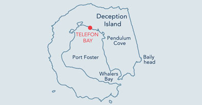
20. Telefon Bay (East), Deception Island |
||||||||||||

|
||||||||||||
|---|---|---|---|---|---|---|---|---|---|---|---|---|
|
||||||||||||
|
||||||||||||
| Description | ||||||||||||
| TOPOGRAPHY | ||||||||||||
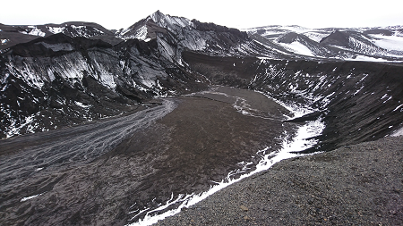
| At the easternmost end of Telefon Bay, a gently sloping beach leads to a broad shallow valley which rises sharply to a number of unnamed volcanic craters. These are up to 45m in depth, although they are slowly being filled in by sediment and ice. The prominent ash cliffs that form the east and west sides of the valley are remnants of an older crater that was modified during an eruption in 1967, which broadened the valley itself. | ||||||||||||
| FAUNA | ||||||||||||
| Hauled out: Antarctic fur seal, Weddell seal. | ||||||||||||
| Resting: Skua. | ||||||||||||
| FLORA | ||||||||||||
|
The site has a generally barren appearance, but close inspection reveals inconspicuous flora (14 species of moss and 8 species of lichen have been recorded from the Telefon Bay area). Immediately adjacent, ASPA 140 (area F) has been designated for its botanical interest primarily because the ground surfaces within the site date from 1967, allowing accurate monitoring of colonisation by plants and other biota.
|
||||||||||||
| Visitor Impact | ||||||||||||
| KNOWN IMPACTS | ||||||||||||
| None. | ||||||||||||
| POTENTIAL IMPACTS | ||||||||||||
| Erosion of paths on crater ridge. Disturbance of scientific equipment. | ||||||||||||
| Landing Requirements | ||||||||||||
| SHIPS* | ||||||||||||
|
Max pax on board: 500
Ships at a time: 1 Comments: Maximum 3 ships per day (midnight to midnight), of which no more than 2 can carry over 200 passengers. * A ship is defined as a vessel which carries more than 12 passengers. |
||||||||||||
| VISITORS | ||||||||||||
|
Maximum number of visitors at any time, exclusive of expedition guides and leaders: 100 Visitors per guide: 20 |
||||||||||||
| Visitor Area | ||||||||||||
| LANDING AREA | ||||||||||||
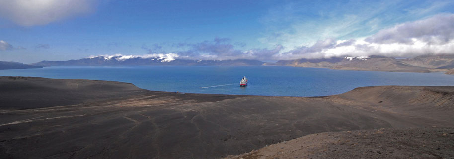
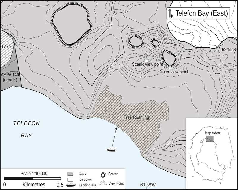
| Beach immediately to the south-west of the crater. | ||||||||||||
| CLOSED AREA | ||||||||||||
| None. | ||||||||||||
| GUIDED WALKING AREA | ||||||||||||
| Visitors will be guided up to the crater in small closely supervised groups, with one guide per group of 1-15. Visitors should be closely supervised at the crater edge. | ||||||||||||
| FREE ROAMING AREA | ||||||||||||
| Visitors may roam freely under supervision in the landing beach area. | ||||||||||||
| Visitor code of conduct | ||||||||||||
| BEHAVIOUR ASHORE | ||||||||||||
|
||||||||||||
| CAUTIONARY NOTES | ||||||||||||
|
• All visits must be planned to take into account the significant risk posed by the threat of volcanic eruption. • Exercise extreme caution when approaching the steep edge of the crater lip. The soil is friable and may collapse underfoot. • If seals are hauled out on the beach, slow down before landing. |
||||||||||||
|
||||||||||||
| Landing beach | ||||||||||||
|
||||||||||||
|
||||||||||||
|
|
Please note that ATCM / CEP circulars are available only to specific contact points.
Please contact your Party Contact Administrator, to confirm if you have privileges to access this section.
To access this section you must log in using your personal Username/Email and password as registered in the AT Contacts Database.
To access this section you must log in using your personal Username/Email and password as registered in the AT Contacts Database.
If you are not registered, please request your party’s Contact Administrator to assign your credentials or contact the Secretariat for assistance.