23. Stonington Island |
||||||||||||

|
||||||||||||
|---|---|---|---|---|---|---|---|---|---|---|---|---|
|
||||||||||||
|
||||||||||||
| Description | ||||||||||||
| TOPOGRAPHY | ||||||||||||
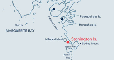
| Stonington is a small island in Neny Fjord at the southern end of Marguerite Bay. It is approximately 750 metres long and 250 metres wide. The island has areas of relatively flat boulder or gravel between rocky outcrops. It was until recently connected to the Antarctic mainland by North East Glacier. | ||||||||||||
| FAUNA | ||||||||||||
| -: Adélie penguin, Skua, Weddell seal. | ||||||||||||
| FLORA | ||||||||||||
| Seven species of lichen and two species of moss have been reported from Stonington Island. | ||||||||||||
| OTHER | ||||||||||||
|
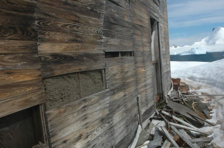
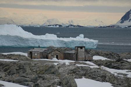
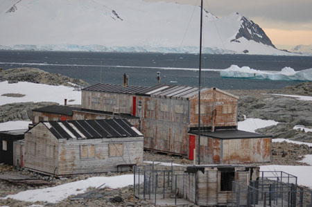
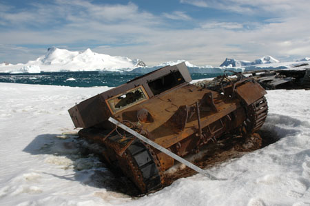
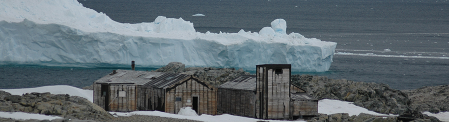
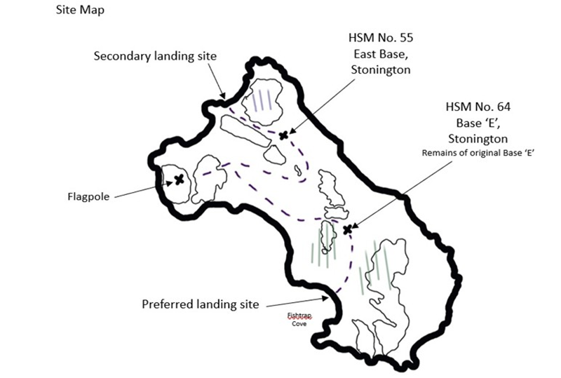
East Base is designated as Historic Site and Monument No. 55 under the Antarctic Treaty. It was established during the United States Antarctic Service Expedition led by Richard E. Byrd (1939-41), and was subsequently occupied during the Ronne Antarctic Research Expedition (1947-1948). The latter included Edith Ronne and Jenny Darlington, the first two women to overwinter in Antarctica. The buildings were also occupied and modified by the UK during the construction and operation of Base ‘E’. Base ‘E’ is designated as Historic Site and Monument No. 64 under the Antarctic Treaty. It was established by the UK in 1946, 100 m from the US East Base. The station closed in 1950 as sea ice conditions prevented access. It reopened in 1960 as the centre for field work in the south Antarctic Peninsula, and a new steel-framed, two story plywood hut was erected in 1961. Stonington served largely as a staging post for access to the peninsula via the North East Glacier. Up to 120 sledging dogs were spanned on the glacier above Stonington Island, which also served as runway for aircraft. The original Base ‘E’ was burnt down by accident in 1972 and only fragmentary remains mark the site. The station closed down in February 1975. |
||||||||||||
| Visitor Impact | ||||||||||||
| KNOWN IMPACTS | ||||||||||||
| None known. | ||||||||||||
| POTENTIAL IMPACTS | ||||||||||||
| Fire. Disturbance to historic artefacts. Minor fuel spills. | ||||||||||||
| Landing Requirements | ||||||||||||
| SHIPS* | ||||||||||||
|
Max pax on board: 500
|
||||||||||||
| VISITORS | ||||||||||||
|
Maximum number of visitors at any time, exclusive of expedition guides and leaders: 100 Comments: No more than 12 visitors are allowed inside any single building at any one time. Visitors must be closely supervised. East Base was proposed as HSM No. 55 by the USA, and Base ‘E’ was proposed as HSM No. 64 by the UK. Visits to Base ‘E’ may only take place with prior permission given by a Party. The Party undertaking management of the site should also be informed prior to the visit. Visitors enter the bases at their own risk and neither the UK nor the US authorities will be liable for any personal injury or damage to property that may be sustained. |
||||||||||||
| Visitor Area | ||||||||||||
| LANDING AREA | ||||||||||||
|
The preferred landing site is in Fishtrap Cove, to the south of the two bases. Secondary Landing near East Base. Be aware of Adelie colony around and en route to Base E from the preferred landing site. |
||||||||||||
| CLOSED AREA | ||||||||||||
|
Access to the East Base is limited to the main hut (via the main doors at the northern end of the building). Visitors should not enter the southern extension, the meteorological tower, the bunk room, the small hut to the south of the bunk room originally used by Finne Ronne and his wife, or the rubbish dump. Access to Base ‘E’ is limited to the main hut and the main generator shed at Base ‘E’. Access is not permitted to any of the attached or associated structures, including the dog pens and jetty. |
||||||||||||
| GUIDED WALKING AREA | ||||||||||||
| None. | ||||||||||||
| FREE ROAMING AREA | ||||||||||||
| Visitors may roam freely under close supervision. | ||||||||||||
| Visitor code of conduct | ||||||||||||
| BEHAVIOUR ASHORE | ||||||||||||
|
||||||||||||
| CAUTIONARY NOTES | ||||||||||||
|
The rocks at the landing site can be slippery when wet. The island is subject to very strong katabatic winds. |
||||||||||||
|
||||||||||||
|
||||||||||||
|
||||||||||||
|
|
Please note that ATCM / CEP circulars are available only to specific contact points.
Please contact your Party Contact Administrator, to confirm if you have privileges to access this section.
To access this section you must log in using your personal Username/Email and password as registered in the AT Contacts Database.
To access this section you must log in using your personal Username/Email and password as registered in the AT Contacts Database.
If you are not registered, please request your party’s Contact Administrator to assign your credentials or contact the Secretariat for assistance.