14. Snow Hill Hut |
||||||||||||

|
||||||||||||
|---|---|---|---|---|---|---|---|---|---|---|---|---|
|
||||||||||||
|
||||||||||||
| Description | ||||||||||||
| TOPOGRAPHY | ||||||||||||
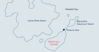
| The hut is found on the northeast coast of Snow Hill Island. The relief is characterized by three distinct units: the topography gradually rises from the coastline to the 5-10 m contour in terraced sedimentary levels. On one of these the Nordenskjöld hut is found. From there up to the 170 m contour, the relief consists of steep slopes (15-40°), which are highly dissected by deep fluvial valleys. This area has abundant fossils of marine origin and is traversed by basalt dikes that run NE-SW. Due to their greater resistance to erosion, these constitute important topographic features. The most important feature is Haslum crag, a small volcanic neck. At the 170 m contour, the topography descends gradually to the Weddell Sea. | ||||||||||||
|
Confirmed breeders: 3-5 nests of kelp gull (Larus dominicanus) and Antarctic tern (Sterna vittata) 500 meters northeast of the hut on the northwest facing slope. |
||||||||||||
| FLORA | ||||||||||||
| Virtually absent. | ||||||||||||
| OTHER | ||||||||||||
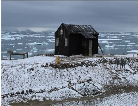
| Wooden hut on Snow Hill Island built in February 1902 by the main party of the Swedish South Polar Expedition led by Otto Nordenskjöld. It was designated as Historic Site and Monument No 38 in the framework of the Antarctic Treaty. The hut contains original objects from the expedition and functions as a museum, which is managed by Argentina and Sweden. | ||||||||||||
| Visitor Impact | ||||||||||||
| KNOWN IMPACTS | ||||||||||||
| Some acts of vandalism in the hut’s interior have been recorded in the past. | ||||||||||||
| POTENTIAL IMPACTS | ||||||||||||
| Worsening of erosive processes -naturally rapid in the area of the location of the hut- due to trampling. Fire. Small fuel leaks. | ||||||||||||
| Landing Requirements | ||||||||||||
| SHIPS* | ||||||||||||
|
Max pax on board: 200
Ships at a time: 1 Comments: Operators will send an email to the Argentine CEP contact points anticipating the visit. Likewise, when there is presence of Antarctic Program personnel working in the hut or surroundings, the expedition leaders will communicate by channel 16 once in the area to coordinate the visit. *A ship is defined as a vessel which carries more than 12 passengers. |
||||||||||||
| VISITORS | ||||||||||||
|
Maximum number of visitors at any time, exclusive of expedition guides and leaders: 100 Visitors per guide: 20 Curfew time period (from/to), in order to establish a rest period for wildlife: 19:00-08:00 Comments: When staff of National Antarctic Programs are working in the area, do not disembark between 19:00 and 08:00 hrs (local time). Visits to the interior of the hut should be conducted in groups of no more than 5 persons at a time. |
||||||||||||
| Visitor Area | ||||||||||||
| LANDING AREA | ||||||||||||
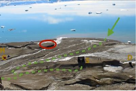
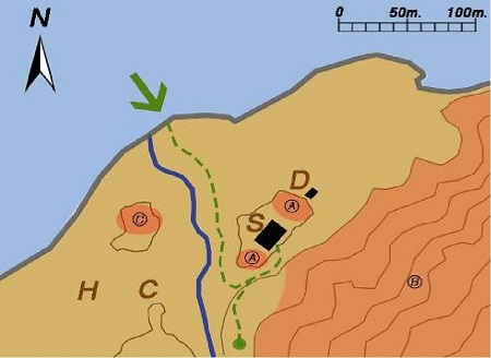
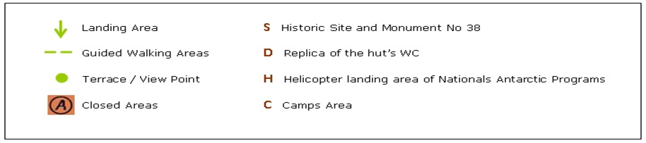
| On the beach facing the hut, northeast of the stream (see map). | ||||||||||||
| CLOSED AREA | ||||||||||||
|
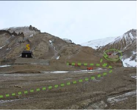
Closed area A: The northeast and southwestern ends of the small terrace on which the hut is located, to avoid the acceleration of erosive processes. These areas are clearly marked with stakes and rope. Closed area B: The entire area with steep slopes. This area has important paleontological deposits. The terrace that is located to the southeast of the hut at 15 meters above sea level and the ascending path to it is excluded from the closed area (see next section) Closed area C: Small sediment hill located 80 meters southwest of the hut, due to the presence of archaeological remains of the magnetic observatory. |
||||||||||||
| GUIDED WALKING AREA | ||||||||||||
|
Visitors should use the path that is shown on the map to go to the hut and return to the landing area. To climb the terrace on which the hut is found, they should only use the stairs. No more than 10 persons at a time are permitted on the terrace on which the hut is located, of which, up to 5 people may enter the hut at a time, as indicated above under the item "visitors in Landing Requirements". Access to the terrace that is located to the southeast of the hut at 15 meters above sea level and to the ascending path, shall only be completed using the access path. (see map). |
||||||||||||
| FREE ROAMING AREA | ||||||||||||
| Visitors can move freely under supervision along the glaciofluvial plain around the landing site and extending southwest of the stream (see map). No visitor access is permitted beyond the slope ridge. | ||||||||||||
| Visitor code of conduct | ||||||||||||
| BEHAVIOUR ASHORE | ||||||||||||
|
||||||||||||
| CAUTIONARY NOTES | ||||||||||||
|
|
||||||||||||
|
||||||||||||
|
||||||||||||

|
||||||||||||
|
|
Please note that ATCM / CEP circulars are available only to specific contact points.
Please contact your Party Contact Administrator, to confirm if you have privileges to access this section.
To access this section you must log in using your personal Username/Email and password as registered in the AT Contacts Database.
To access this section you must log in using your personal Username/Email and password as registered in the AT Contacts Database.
If you are not registered, please request your party’s Contact Administrator to assign your credentials or contact the Secretariat for assistance.