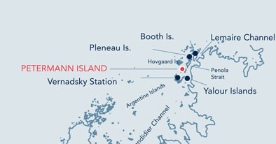
9. Petermann Island |
|||||||

|
|||||||
|---|---|---|---|---|---|---|---|
|
|||||||
|
|||||||
| Description | |||||||
| TOPOGRAPHY | |||||||
| This 1km-long island rises up to approximately 150 metres above sea level. An ice-cap covers part of the northwestern end of the island and a crevassed permanent ice-slope largely covers the southern end of the island. Many small cobbled bays indent its coastline, with nearly continuous rocky outcrops along the shore. | |||||||
| FAUNA | |||||||
| Confirmed breeders: Adélie penguin, Blue-eyed shag, Gentoo penguin, Snowy sheathbill, South Polar Skua, Wilson’s storm petrel. | |||||||
| FLORA | |||||||
| Deschampsia antarctica; swards of moss species; Xanthoria spp., Caloplaca spp., and other crustose lichens; and the green alga Prasiola crispa are present. Snow algae may be extensive. | |||||||
| OTHER | |||||||
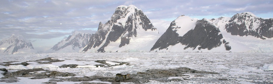
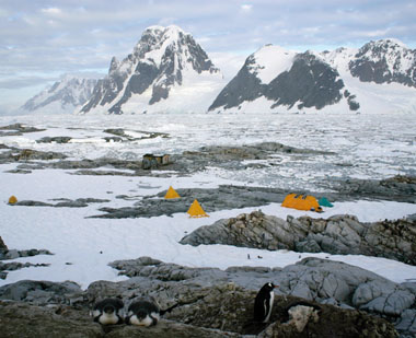
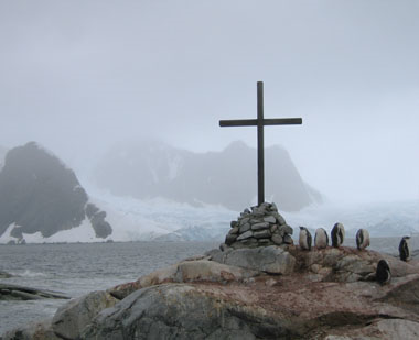
| Charcot’s second French Antarctic expedition wintered aboard the Porquois-Pais at this location and a number of associated artefacts remain visible, including a cairn (Historic Site and Monument No. 27), chains, a tide mark and the letters ‘PP’ engraved in stone. On the site there is an Argentine refuge hut. The death of three members of the British Antarctic Survey in 1982 is marked by a commemorative cross. | |||||||
| Visitor Impact | |||||||
| KNOWN IMPACTS | |||||||
| None. | |||||||
| POTENTIAL IMPACTS | |||||||
| Disturbance of wildlife, trampling of vegetation and damage to historic artefacts. | |||||||
| Landing Requirements | |||||||
| SHIPS* | |||||||
|
Max pax on board: 500
Ships at a time: 1 Comments: Maximum 3 ships per day (midnight to midnight), of which no more than 2 can carry over 200 passengers. * A ship is defined as a vessel which carries more than 12 passengers. |
|||||||
| VISITORS | |||||||
|
Maximum number of visitors at any time, exclusive of expedition guides and leaders: 100 Visitors per guide: 20 Comments: No visitors ashore between 22:00hrs and 04:00hrs (local time), except for those engaged in organised overnight stays. This is in order to establish a resting period for the wildlife. |
|||||||
| Visitor Area | |||||||
| LANDING AREA | |||||||
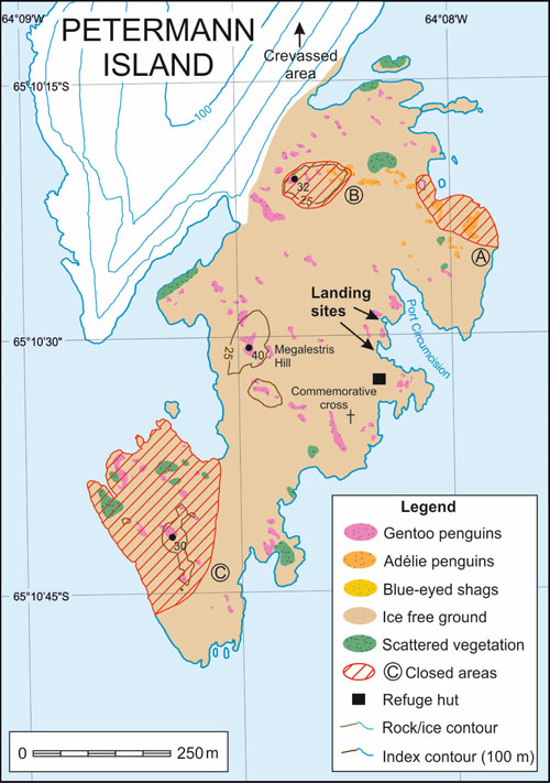
| Along the shoreline in Port Circumcision. | |||||||
| CLOSED AREA | |||||||
|
Closed Area A: Breeding Adélie penguins and blue-eyed shags in the vicinity of the basaltic dyke at the northeastern tip of the island. Closed Area B: Breeding Adélie penguins at higher elevations northwest of Port Circumcision. Closed Area C: Southwestern end of the island, with breeding skuas, gentoo penguins and Wilson’s storm petrels, and vegetation. |
|||||||
| GUIDED WALKING AREA | |||||||
| Due to the terrain and proximity of birds the walk to the cairn on Megalestris Hill should be attempted only in small guided groups. Walks to the view point at the southern end of the island should be marked or guided. Note that the area north of Closed Area A and B has less room for visitors and a higher likelihood of disruption to the wildlife. Therefore guides should discourage visits to this area. | |||||||
| FREE ROAMING AREA | |||||||
| Visitors may roam freely, but under close supervision, except in the closed or guided walking areas. Given the irregular topography at this site, guides should be aware that it is more difficult to ensure the necessary supervision of visitors. | |||||||
| Visitor code of conduct | |||||||
| BEHAVIOUR ASHORE | |||||||
|
|||||||
| CAUTIONARY NOTES | |||||||
| The ice cap to the north west of the island is steep and crevassed and should be visited only with suitably experienced and equipped guides. | |||||||
|
|||||||
|
|||||||
| Petermann Island - refuge hut, historical features and scientific activities | |||||||
|
|||||||
| Commemorative cross | |||||||
|
|||||||
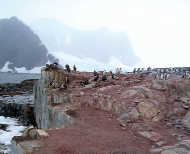
| Blue eyed shags in the vicinity of the balsatic dyke (NE Petermann Island) | |||||||
|
|
|||||||
|
|||||||
|
|
Please note that ATCM / CEP circulars are available only to specific contact points.
Please contact your Party Contact Administrator, to confirm if you have privileges to access this section.
To access this section you must log in using your personal Username/Email and password as registered in the AT Contacts Database.
To access this section you must log in using your personal Username/Email and password as registered in the AT Contacts Database.
If you are not registered, please request your party’s Contact Administrator to assign your credentials or contact the Secretariat for assistance.